
About uMORPH

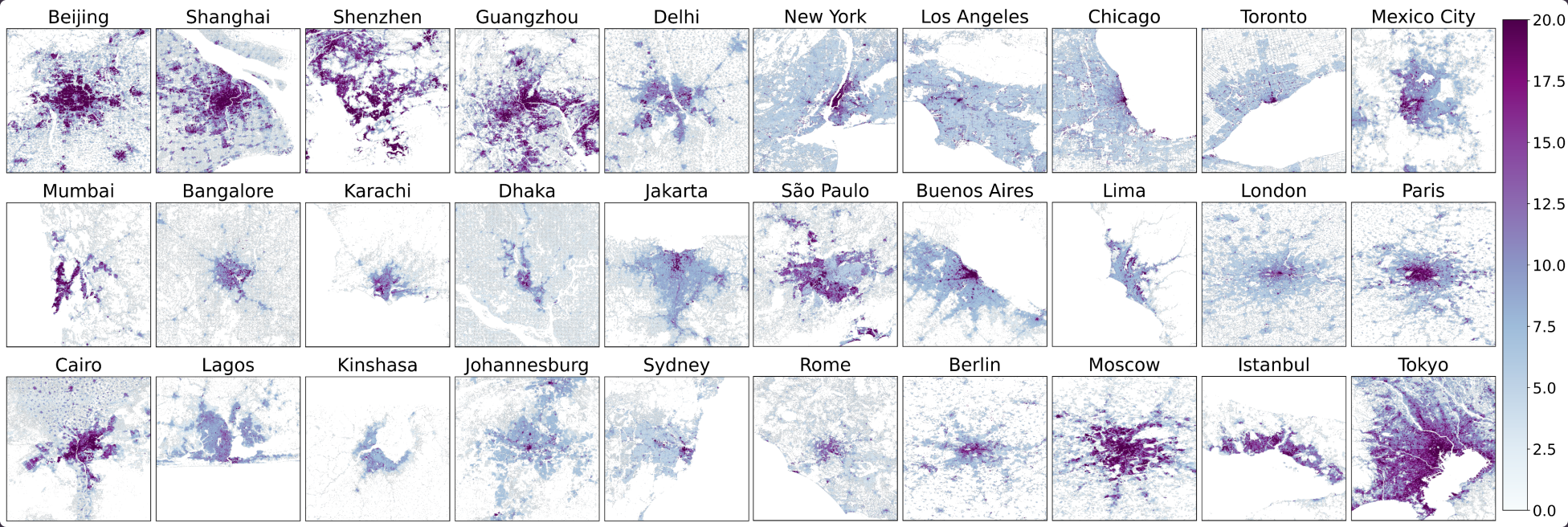
uMORPH v1.0 is a global urban morphology dataset of Level-of-Detail-1 (LOD1) building footprints with heights and 100-meter urban canopy parameters (UCPs), covering 98.4% cities or locales with populations over 50,000, representing 7.84 billion people (94.5% global population), spanning all continents. uMORPH is generated using a 2 x 2 degree tile-based workflow, thus coverage extends beyond the target cities, and also includes cities lesser than 50,000 people within each processed tile.
uMORPH integrates building footprint and height data from Overture Maps Foundation (v1.9.0–v1.10.0, sourced from OpenStreetMap, Google, and Microsoft), with height infilling from the Global Human Settlement Layer Average Net Building Heights (GHSL ANBH, R2023A) where native heights were unavailable. Building geometries and heights (~2.38 billion footprints) are provided as GeoParquet vector tiles, and seven derived UCPs — mean building height, area-weighted mean building height, standard deviation of building height, plan area fraction, building surface-to-plan area ratio, frontal area index (4 directions), and building height distribution (15 bins; 0-75 m), totaling 24 raster layers — are distributed as global Cloud-Optimized GeoTIFFs (100 m, WGS84) and as WRF/WPS geogrid binaries (organized by continent) compatible with the SLUCM, BEP, and BEP+BEM urban canopy schemes. It is intended to support neighborhood-scale urban climate modeling and machine-learning applications requiring consistent, global-coverage building morphology and urban canopy data, as well as other urban applications and GIS visualization systems.
Cite uMORPH
Cite the publication first; cite the dataset and code where your work depends on them directly.
Publication
Jain, M., Ortiz, L. E., & McPhearson, T. (2026). uMORPH: An open, neighborhood-scale, global urban MORPHology data for cities. (Forthcoming).
Data
Jain, M., Ortiz, L. E., & McPhearson, T. (2026). uMORPH: Global LOD1 buildings and 100-meter urban canopy parameters dataset. New York University. https://doi.org/10.58153/mrt3g-htt3 [Accessed via https://umorph.urbansystemslab.com/]
Code
Jain, M., Ortiz, L. E., & McPhearson, T. (2026). uMORPH: Global LOD1 buildings and 100-meter urban canopy parameters code. New York University. https://doi.org/10.58153/05epr-8f567
FAQs
Why geoparquet and cloud optimzed GeoTIFFs over standard vector and raster formats? 

Each tile is a single parquet file in WGS84 (EPSG:4326) containing building footprint polygons with LOD1 height attributes. Parquet loads directly in GeoPandas, DuckDB, QGIS, and most 3D-rendering pipelines.
Can I download a whole continent at once?
Answer coming soon.
Why does my area show as empty?
Answer coming soon.
How large is the full dataset, archived vs. unarchived?
Answer coming soon.
How do I cite uMORPH?
Answer coming soon.
Collaborate with us
Questions, corrections, or ideas for working together? Send us a note.